
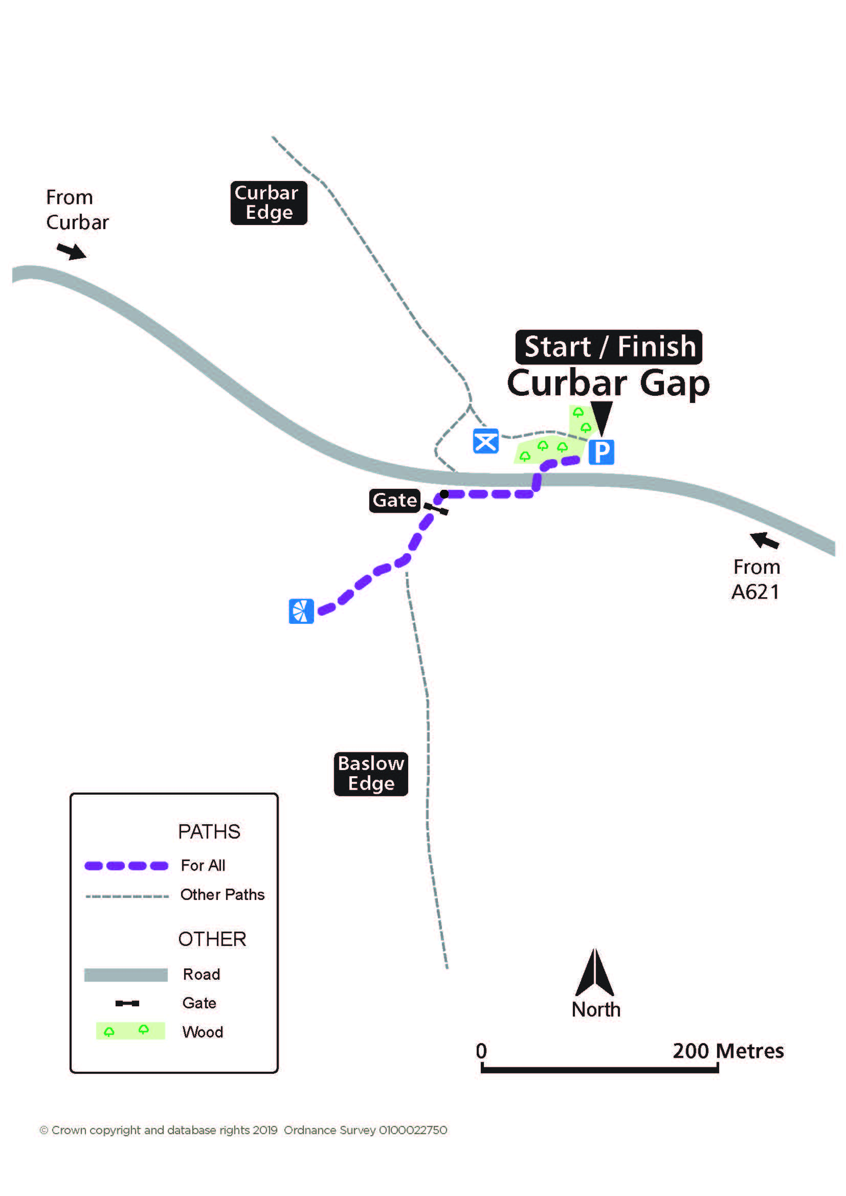
Curbar Gap
A short route to an extensive panorama of the Derwent Valley from one of its renowned gritstone edges. Highland cattle grazing. Picnic area with views.
Access for All
Distance: 260 m to the viewing area
Nearest Facilities: Calver and Baslow
Directions
- Cross the road at the opposite end to the car park entrance.
- Follow the track and wall past the field.
- Pass through the gate and turn right off the main track to a viewing area.
Curbar Gap Route Map (320KB) ![]()
Alternative
A path from the rear right-hand corner of the car park leads to the picnic area.
Getting there
Start at Curbar Gap Car Park above Curbar via the A623 or from the A621 Baslow to Sheffield Road.
Ordnance Survey grid reference: SK 2623 7470
Postcode: S32 3YR
Do you know?
- The road through Curbar Gap was an important packhorse route which became a turnpike, with tolls payable, in 1759. A stone guide stoop, showing the way, can be seen close to the car park entrance.
- The gritstone, being more resistant to erosion, forms a succession of crags above the River Derwent far below.
- There are over 1000 climbing routes on these gritstone edges, including the classic Peapod above the road.