
Damflask
Follow the water’s edge in the heart of Sheffield’s Lakeland. Section on pavement and on the road, if linking to Low Bradfield.
Access for All and Many
Distance: 820 m to the ramp, an additional 1.7 km south-side, 1.7 km north-side
Nearest Facilities: Low Bradfield
Directions
Access for All
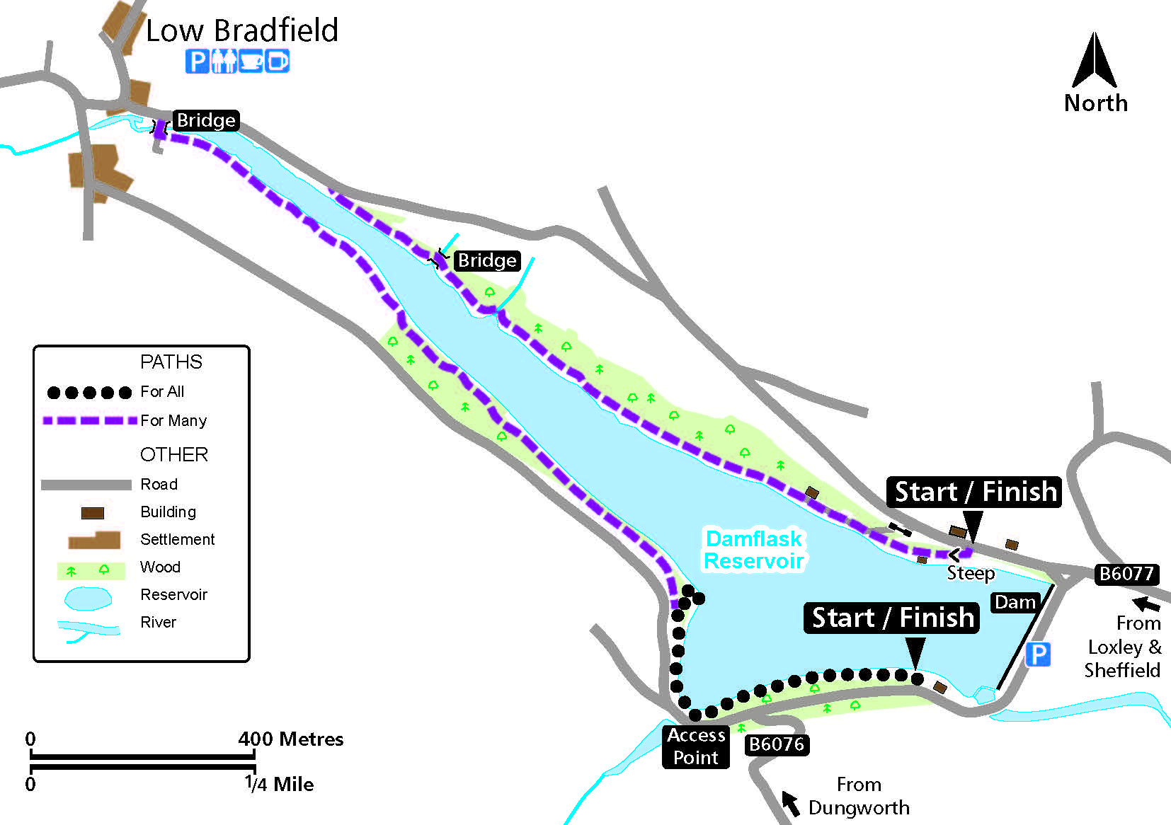
- Start at the south end of the dam where the path is met.
- Continue to the tactile interpretation panel at the access point.
- Continue to where the path drops down to the shore with a ramp to the water’s edge
Access for Many
- Keep left at the turn off to the ramp and continue via a series of undulations, before levelling out and continuing to the edge of Low Bradfield.
Or
- Start at the north end of the dam where a steep slope leads down to the reservoir side.
- Pass the sailing club and continue to where the road is met near Low Bradfield.
Alternatives
Beware passing traffic if the decision is made to continue along the road to Low Bradfield or to join the other track.
Damflask Route Map (1MB) ![]()
Getting there
Damflask Dam, via the B6077 in the Loxley Valley.
Ordnance Survey grid reference: SK 2841 9067
Postcode: S6 6SQ
Do you know?
- In 1864, 240 people and 693 animals drowned and Damflask village was washed away in the Great Sheffield Flood, caused by the collapse of the Dale Dyke Dam upstream.
- In autumn, the azure blue of the reservoir contrasts with the brilliant yellow of the deciduous larches.
- The 2 km stretch of water is home to three Sheffield rowing clubs.