
Ladybower
Drop down to the dam at Ladybower to link the shores of the Peak District’s largest expanse of water. Section on pavement.
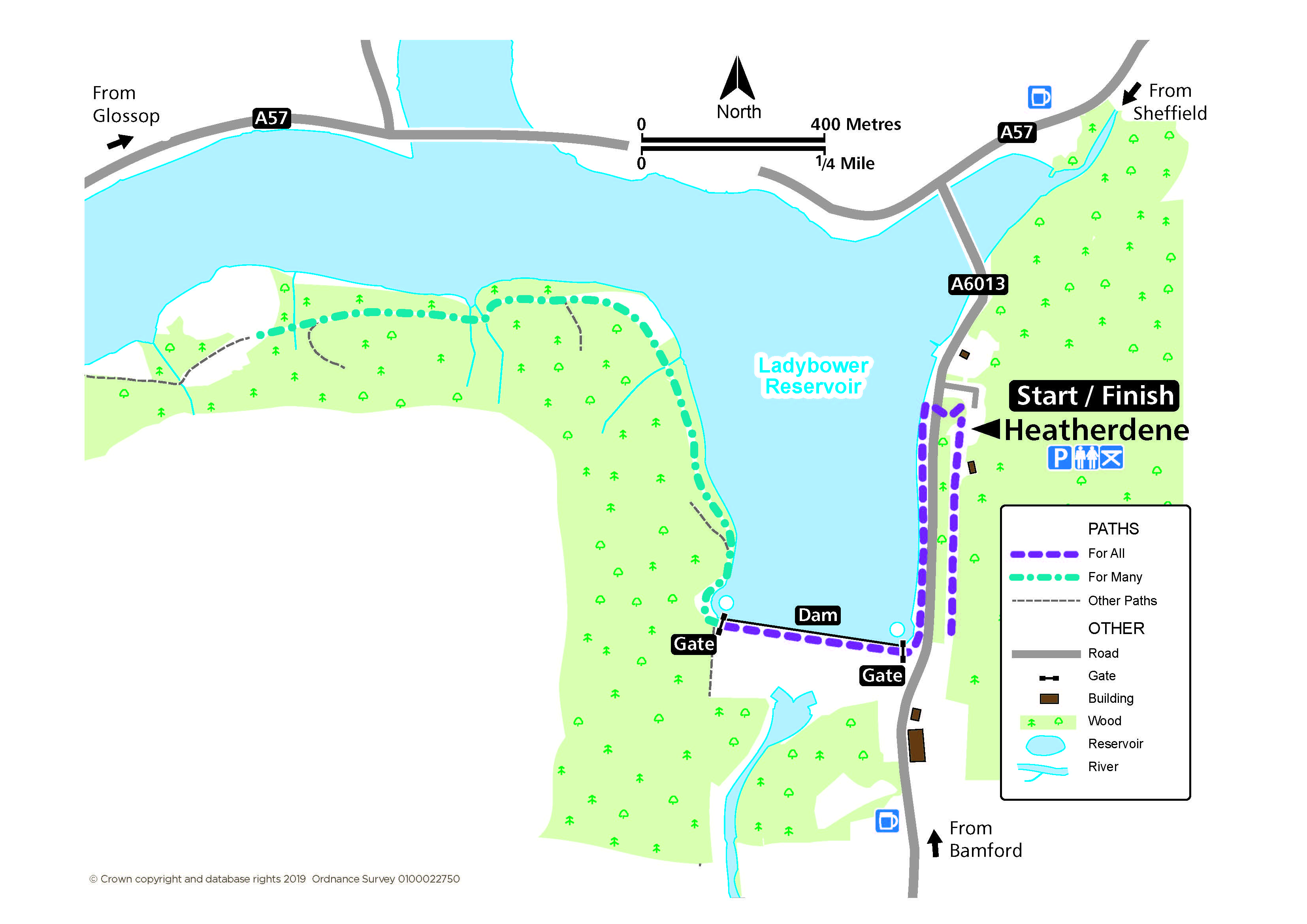
Access for All and Many
Distance: 400 m for views of the dam, 1 km along the dam, 1.5 km to extend
Nearest Facilities: Heatherdene car park
Directions
Access for All
- From the car park, head south past the building and along the tarmac path for elevated views of the dam.
- Return to the car park at the northern end and drop down through the woodland to meet the road.
- Cross the road to the pavement southwards to the dam.
Access for Many
- Turn right at the far side of the dam.
- Follow the forest track to benches and a view.
Alternative
Consider taking out the wheelyboat at Ladybower Fisheries.
Lady Bower Route Map (372B) ![]()
Getting there
Start at Heatherdene Car Park off the A6013 Bamford road.
Ordnance Survey grid reference: SK 2023 8588
Postcode: S33 0BY
Do you know?
- The three linked reservoirs of Howden, Derwent and Ladybower cover 210 hectares to give the largest expanse of water in the Peak District.
- At times of exceptional drought, the remains of the submerged Ashopton village may be seen near the concrete A57 road bridge.
- The two giant plugholes drain away excess water to prevent damage to the dam.