
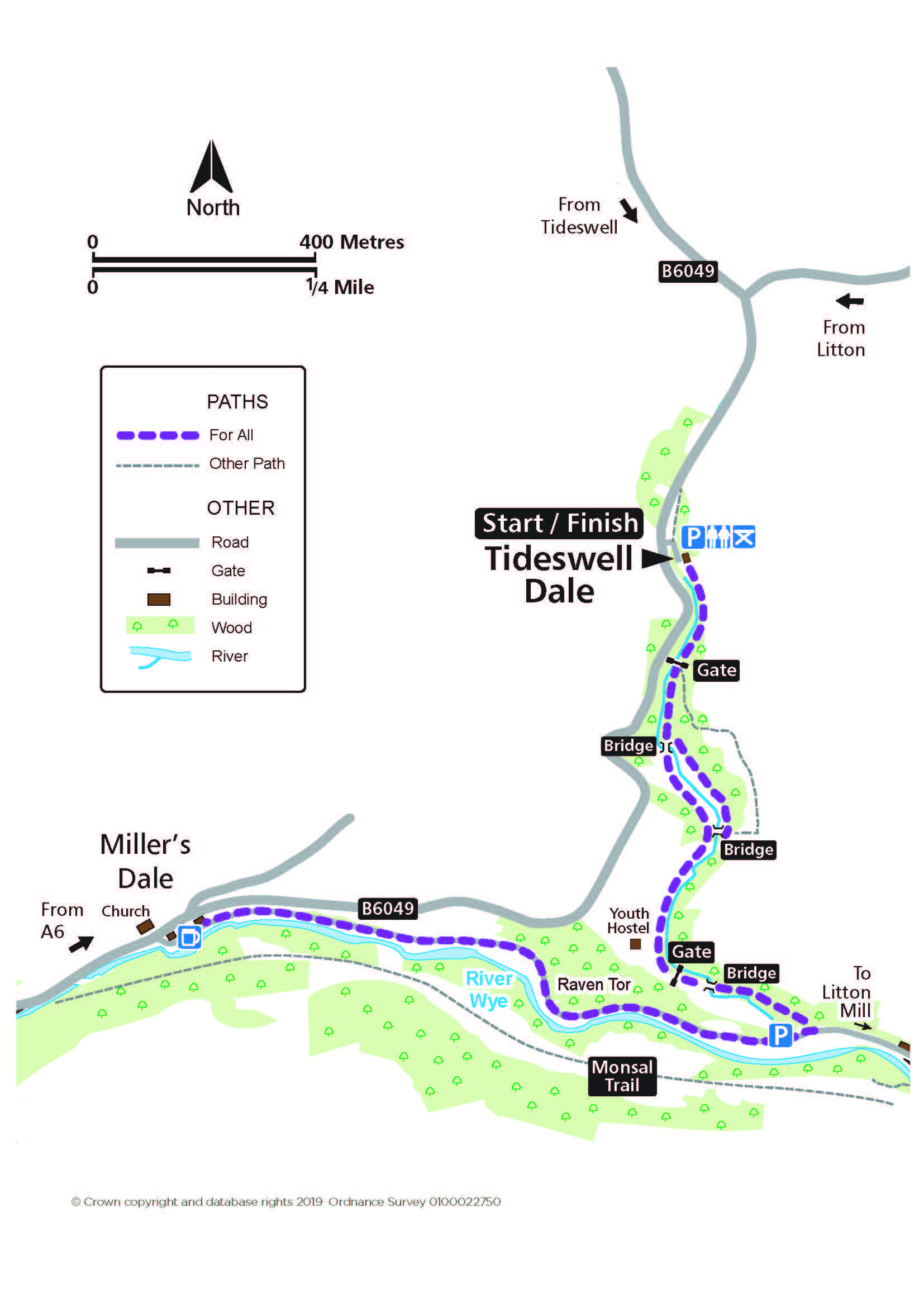
Tideswell Dale
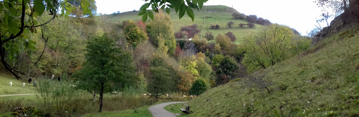
Enjoy moving at the pace of the river’s flow in a landscape telling a story of former industry. Local traffic on the road to Litton Mill. Livestock grazing.
Access for All
Distance: 3.2 km to Miller's Dale
Nearest Facilities: Tideswell and Miller's Dale
Directions
- Take the path past the building and through the gate to the sculpture and the first bridge.
- Continue on either path to the second bridge.
- Continue down the dale following the stream to meet the road.
- Turn right and follow the road and the River Wye upstream to Miller’s Dale.
Alternatives
Start from the parking area before Litton Mill for a shorter route to Miller’s Dale (1.6 km) or for reversing the route along Tideswell Dale. The upper loop from the car park is 1 km.
Tideswell Dale Route Map (368KB) ![]()
Getting there
Start at the car park at Tideswell Dale via the B4049, south from Tideswell or from the A6 Buxton to Bakewell Road.
Ordnance Survey grid reference: SK 1538 7418
Postcode: SK17 8SN
Do you know?
- The wealth of wildflowers, includes bloody cranesbill, a dramatic wild geranium, appearing in June below the climbing proving ground of Raven Tor.
- Magma has baked the surrounding rocks, creating columns in the clays and transforming limestone into marble.
- The River Wye powered two cotton mills downstream - Litton Mill and Cressbrook Mill.