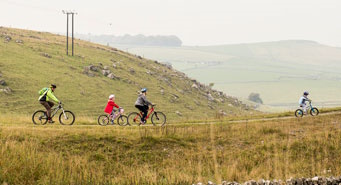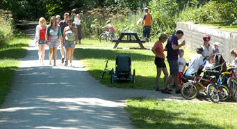
Trails
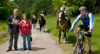
There are four distinct recreational trails, all of which were former railway lines, acquired by the Authority in the late 1970s, 1980s and in the case of the Thornhill Trail, early 1990s. We saw the potential of these disused railway lines, to provide excellent recreational routes through beautiful countryside, and for these to be suitable for all. In total we own and manages 34 miles of trail.
Lightweight transport vehicles (also known as 'e-scooters') are not permitted on our trails network.
High Peak Trail
- Dowlow, south of Buxton to Daisy Bank, Longcliffe - 10.5 miles, Public Bridleway, owned by Peak District National Park Authority
- Daisy Bank, Longcliffe to High Peak Junction, Cromford (outside National Park) - 7 miles, Public Bridleway, owned by Derbyshire County Council.
Find out more about the High Peak Trail.
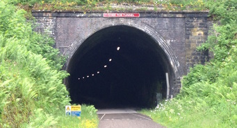
Monsal Trail
- Coombs Road, Bakewell to Blackwell Mill, Wyedale - 8.5 miles, Concessionary route, owned by Peak District National Park Authority.
Find out more about the Monsal Trail.
Thornhill Trail
- North of Thornhill Lane to Yorkshire Bridge - 2 miles, Concessionary route, owned by Peak District National Park Authority.
Tissington Trail
- Mapleton Lane, Ashbourne to Parsley Hay (joins HPT) - 13 miles, Public Bridleway, owned by Peak District National Park Authority.
Find out more about the Tissington Trail.