Landscape Strategy
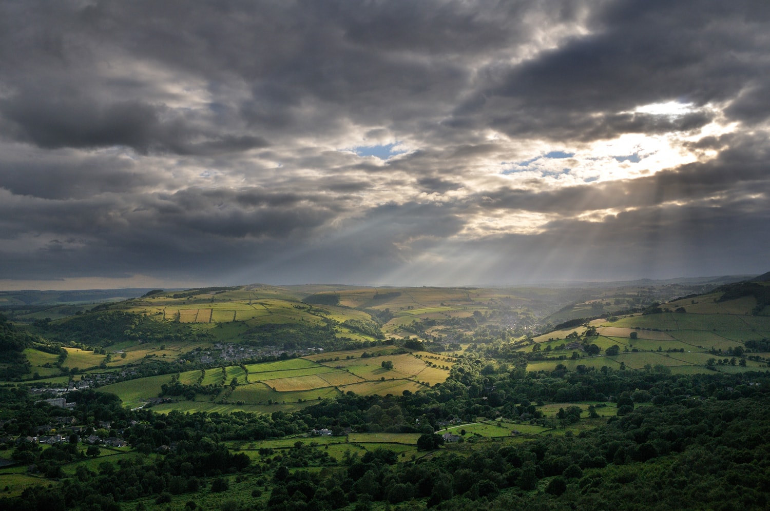
The Peak District National Park was Britain's first National Park. It is a treasured landscape that has been shaped by the long interaction of natural and cultural forces. The diverse landscape of the Peak District contrasts with surrounding adjoining industrial and urban landscapes, enriching the lives of everyone who visits and lives there.
The landscape also provides many other essential services to support life, including supplies of fresh water and storage of carbon, and economic activities, such as farming, tourism and mineral extraction.
The European Landscape Convention defines landscape as:
an area, as perceived by people, whose character is the result of the action and interaction of natural and/ or human factors
Landscape character
The Peak District National Park contains an amazing variety of landscapes including broad open moorlands, more intimate enclosed farmlands and wooded valleys. The landscapes have been shaped by variations in geology and landform and the long settlement and use of these landscapes by people. Today's landscapes have a rich diversity of natural and cultural heritage and this diversity is enjoyed by local communities and visitors.
Landscape Character Assessment is a tool for identifying what makes one place different from another. It identifies what makes a place distinctive and does not assign value to particular landscapes. Landscape Character Assessment provides a framework for describing an area systematically, ensuring that judgements about future landscape change can be made based on knowledge of what is distinctive.
This document is an update to the original 2009 Landscape Strategy and Action Plan. The original 2009 study gathered information from published maps and documents, completed a full field survey of the National Park and held a series of consultation workshops to gather the views of local communities. Formal consultation was carried out on the draft report and amendments made to the maps and text documents.
The 2009 report divided the landscapes of the National Park and its surrounding area into a series of Landscape Character Areas representing broad tracts of landscape which share common characteristics. Within each Landscape Character Area a number of Landscape Character Types were defined based upon the pattern of natural and cultural characteristics.
The original report covered the period up to 2019. It has since been reviewed and updated.
The eight Landscape Character Areas establish a baseline of the current character and historical development of the landscape and will help to promote appreciation and understanding of the landscape of the National Park.
The ‘guiding future change’ section outlines the Authority’s desired landscape outcomes for the individual Landscape Character Types.
Interactive map
The Landscape Character Areas and Landscape Character Types can be seen in the interactive map available below.
Landscape Strategy
The Landscape Strategy forms one of the three core policy documents for the National Park (the others being the Management Plan and the Local Plan.
The updated Landscape Strategy has been broken into eleven individual sections, which can be viewed or downloaded using the links below.
Please note you will need Adobe Acrobat Reader to be able to view the documents.
Sections
- Introduction (13MB)
- White Peak (16MB)
- Dark Peak (10MB)
- Dark Peak - Western fringe (18MB)
- Dark Peak - Yorkshire fringe (15MB)
- Dark Peak - Derbyshire Peak fringe (12MB)
- Derwent Valley (18MB)
- Eastern Moors (19MB)
- South West Peak (18MB)
- Guiding Landscape Change in the Peak District (15MB)
- Where the landscape outcomes are important in the Peak District - Appendix 1 (5MB)
Wooded Landscapes Plan
The Wooded Landscapes Plan for the Peak District was adopted on 3 December 2021, and provides guidance on opportunities for increasing tree and shrub cover in the Peak District, based on landscape character.
- Wooded Landscapes Plan (Final Draft - July 2022) Appendix 2 (20MB)