
Conksbury
A gentle route following the River Lathkill through an area immersed in history. Livestock grazing.
Access for All
Distance: 510 m one-way
Nearest Facilities: Over Haddon and Youlgrave
Directions
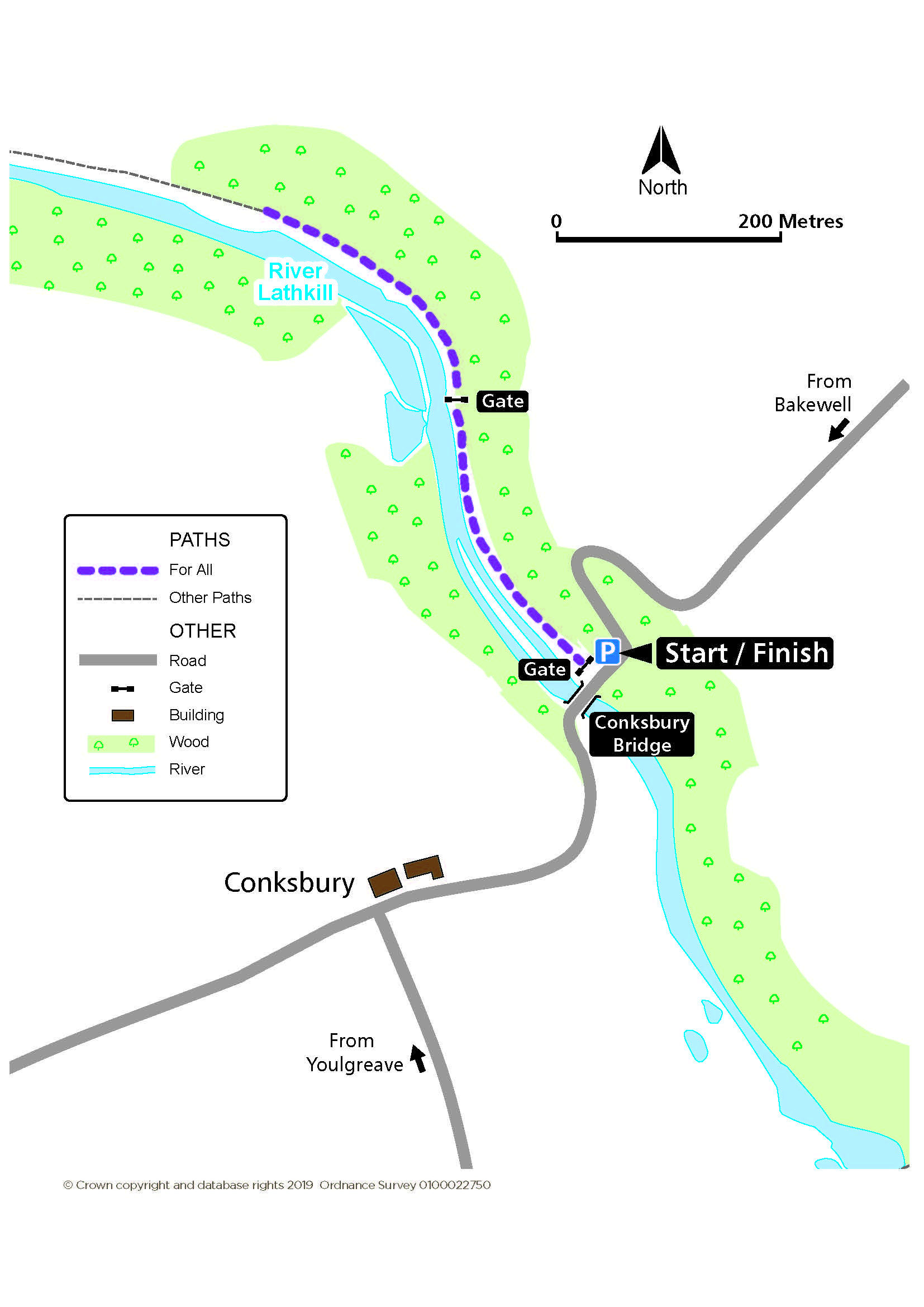
- Start from the disabled parking space just above the medieval Conksbury Bridge to follow the surfaced path.
- Pass through the next gate to continue by the side of the river.
Conskbury Route Map (320KB) ![]()
Getting there
Start at Conksbury Bridge, north of Youlgreave, near Bakewell.
Ordnance Survey grid reference: SK 2119 6565
Postcode: DE45 1JW
Do you know?
- A Vickers Wellington bomber crashed near here in 1941 after losing its way back from a mission. The crew had bailed out beforehand.
- The deserted medieval settlement of Conksbury, documented in the Domesday Book (AD1086) and identifiable now by its earthwork remains, lies on the plateau on the other side of the river.
- Dippers and other waterbirds frequent the river’s weirs, which were created to encourage fish breeding.