Bakewell Family Walk

Part of our series of Family Walks Guides available across the Peak District. Printed copies are available in our Visitor Centres.
Bakewell and the River Wye
Wander along the beautiful River Wye, where you may spot water vole, kingfisher, and some of the biggest trout you have ever seen!
Start from here
Visitor centre, parking (pay and display), toilets, cafes
Driving directions
Postcode: DE45 1DS
Grid reference: SK 218 685
Nearby facilities
Your walk details
Distance: 2 miles / 3.2km
Duration: 1 hour
Buggy Friendly? All-terrain buggy only
Dog Friendly? Yes, but dogs need to be kept on a lead
Parking: Several Pay and Display car parks
Extra information Most of the route follows surfaced pavement but also crosses a field next to the river. The route crosses a busy road in the town so using a pedestrian crossing here is recommended
Routemap and directions
Download Bakewell Family Walk routemap leaflet (744.7 KB)
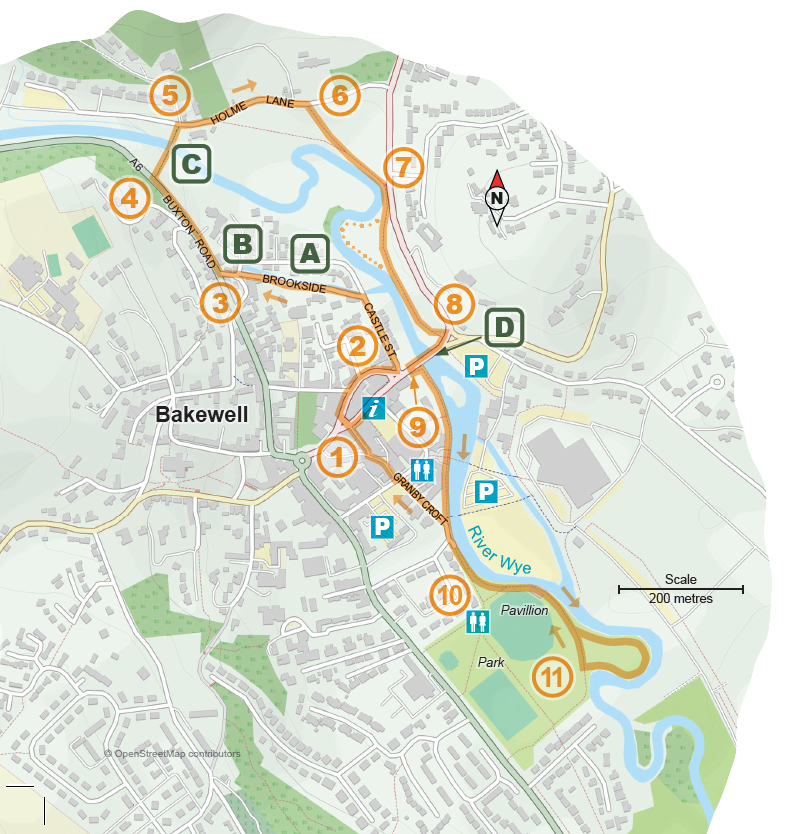
01. From the Bakewell Visitor Centre walk towards the NatWest Bank on Water Lane and turn right to cross the pedestrian crossing. On the other side turn right, passing Bath Street and New Street and the Castle Inn pub before turning left into the attractive Castle Street.
02. Follow Castle Street to the end and just before the small bridge turn left onto a footpath next to the millstream (known as Brookside).
A The millstream known as Brookside is a great place for watching large rainbow trout, especially when the water level is high.
03. Follow the footpath to the end crossing a small parking area (Mill Street) to join the A6 Buxton Road. Turn right following the pavement along the A6, passing the Fire Station.
B Victoria Mill is converted to flats but there is a huge old metal water wheel in the car park. It was used to turn grindstones for grinding corn. Along the mill stream there are often nesting coots and moorhens in spring.
C. Holme Bridge was built in 1664 when many of the goods that crossed the Peak District were carried on the backs of horses in long lines known as packhorse trains. The horses walked through the ford but pedestrians could keep their feet dry. The sheepwash was used by local farmers who drove their sheep into the water to wash the fleeces before shearing, to fetch a greater price for their wool.
04. A short distance after the Fire Station turn ight onto a path leading to Holme Bridge. On the left is the old sheepwash and a small shaded sitting area.
05. Pass over the bridge and turn right onto Holme Lane.
06. Along Holme Lane take a path leading across the roadside field on your right stepping down to a gate with a Public Footpath sign.
07. On the far side of the field take the right-hand gate and pass along a narrow path next to the river to reach Scott’s garden. You can then either follow the riverside or take the surfaced path to reach Bakewell Bridge.
08. Pass through the black metal gate, stepping up to the road and turn right, following the narrow pavement (take care) over the bridge.
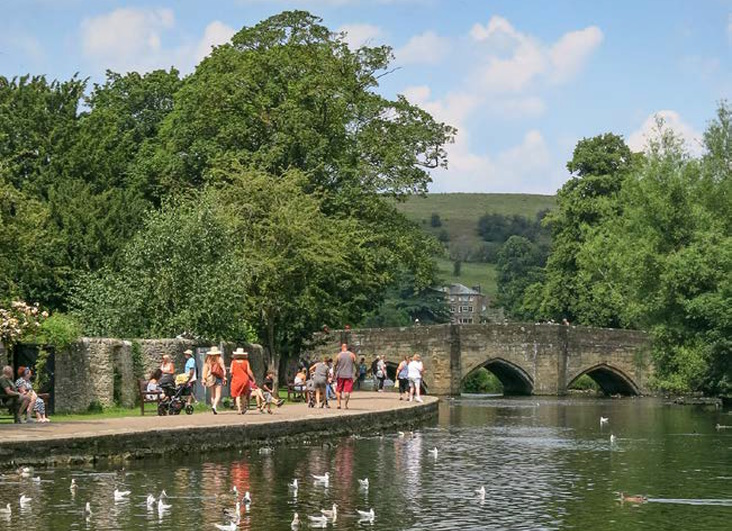
D The road bridge in Bakewell is home to a breeding colony of Daubenton’s bats in summer. They can be seen at dusk, flying under the arches to feed on insects along the river. Bakewell riverside is a lovely place to interact with ducks and geese (but please do not feed them, as it is bad for their health).
09. On the far side of the bridge, cross the road and take the path to the riverside, left between the bridge and buildings. Continue along the riverside path past the bridge covered with padlocks (do not cross the bridge) and continue until you reach the town park.
10. On entering the park follow the path on your left, passing behind the Pavilion, until a large grassy area on your left, enclosed by a big bend in the river.
11. Return to the town centre the way you came or by taking Granby Croft instead of the riverside walk.
Explore more
The following places are all close to Bakewell Family Walk so why not make a day of it?


